The Elbruz Map Department has released some special maps.
Folio editions can be ordered for free.
All maps are available in the following formats:
- small, 0.30m x 0.20m
- medium, 1.20m x 0.80m
- large, 2.40m x 1.60m
Please contact your local Elbruz agent for details or inquire info@elbruz.org.
The first series contains the following maps (all Robinson projection):
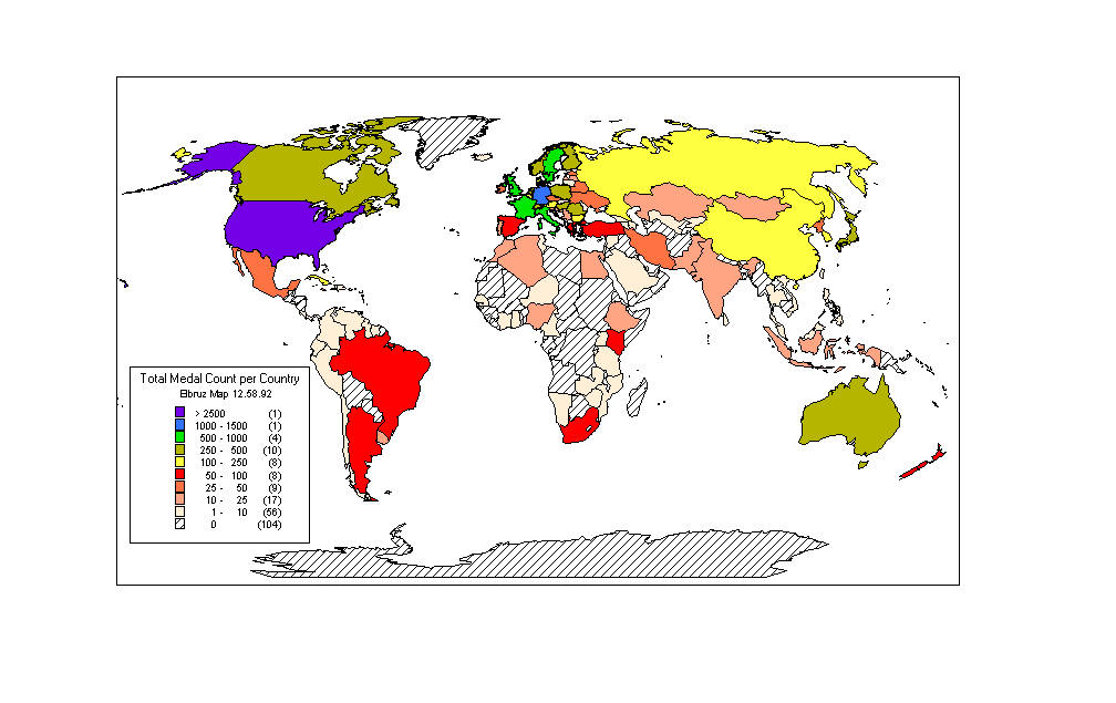
1) Elbruz Map 12.58.92– Olympic Medals per Country
This map gives an overview of the total medal count (unweighted)
per country. See some explanatory notes.
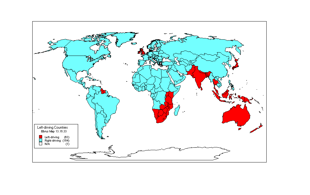
2) Elbruz Map 13.15.33 – Left-driving Countries
This map gives an overview of all left-driving countries (situation 1999). The information was gathered by the Elbruz Travel Assistance Club (ETAC), an Elbruz support organization aiming at world-wide assistance to Elbruz members.
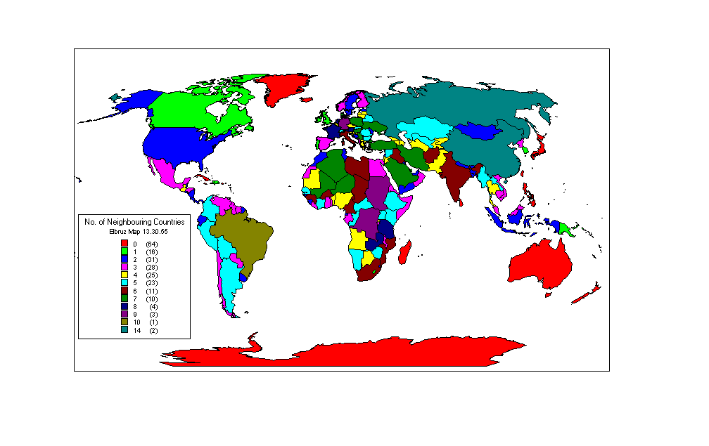
3) Elbruz Map 13.30.55 – No. of Neighbouring Countries
This map gives an overview of the number of neighbouring countries for all countries
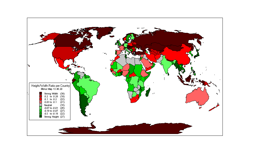
4) Elbruz Map 13.48.20 – Height/Width Ratio per Country
This map is constructed by comparing the maximum North-South distance and East-West distance. The resulting ratio is an indicator of the “heightness” or “widthness” of a specific country.
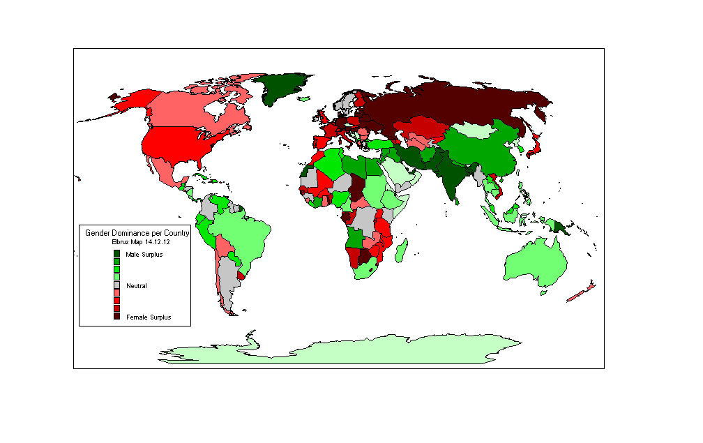
5) Elbruz Map 14.12.12 – Male/Female Ratio per Country
This map is constructed by comparing the male and female population. The resulting ratio is an indicator for a gender surplus in a specific country.
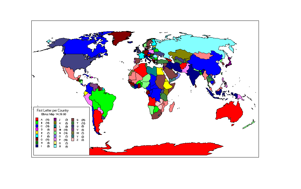
6) Elbruz Map 14.39.90 – Countries sorted alphabetically
This map is constructed by sorting countries by alphabet
It is important to note that the maps are based on different sources. In most cases more entities are mapped than the 193 Elbruz certified countries.
While every precaution has been taken in preparation of these maps, Elbruz assumes no responsibilty for errors or omissions, or for damages resulting from the use of the information contained herein.
For further information please contact maps@elbruz.org